
Typhoon Krosa
Status: Closed
| Type of posting | Posting date(EST): | Summary | Downloads |
|---|---|---|---|
| Landfall | 10/7/2007 1:00:00 PM |
|
Landfall | Summary
Posting Date: October 7, 2007, 1:00:00 PM
Taiwan continues to feel the effects of rainbands from Typhoon Krosa, which crossed the northernmost part of Taiwan yesterday after a fitful first landfall near Su-ao in southern Ilan (Yilan) County. Krosa then crossed the Taiwan Strait to make landfall near the border of mainland China's Fujian and Zheijang provinces. As of the Japan Meteorological Agency (JMA) 18:50 UTC advisory, Krosa is now a tropical storm with maximum sustained winds of 64 mph. The storm is currently moving slowly to the north-northwest, but is expected to turn sharply to the east within the next twelve hours and exit into the East China Sea, well south of Shanghai.Yesterday, sustained winds at Krosa's first landfall were near 115 mph with higher gusts, according to the Central Weather Bureau (CWB). The first landfall occurred farther south than originally expected and was likely influenced by Taiwan's Central Mountain Range with peaks near 12,000 ft. These mountains frequently influence typhoons that approach Taiwan. On occasion, they have been known to actually split a typhoon into two separate storms. With Krosa, the mountains deflected the storm southward as it penetrated slightly inland. Hours later, however, the winds ahead of an approaching cold front in eastern China, in conjunction with the primary steering flow from the Pacific subtropical high, returned Krosa to its previous northwesterly path. This resulted in a second landfall along the northern tip of Taiwan. The resulting slow-motion cycloidal path caused a prolonged period of high winds and torrential rain along the coast.
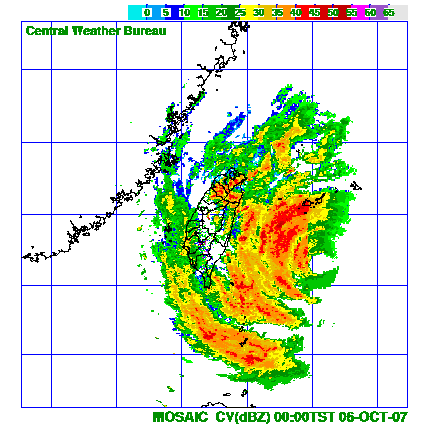 |
| Radar Loop Showing Krosa's Double Landfall (Source: CWB, AIR) |
Krosa damaged roofs, blew down billboards and awnings, and uprooted trees across northern Taiwan. While AIR does not expect significant structural damage to the reinforced concrete construction that dominates the country, there is likely to be widespread wind damage to non-structural elements. Flooding will cause further damage to building contents. Fortunately, Krosa's ultimate track just inland along the coast meant that the storm's strongest winds remained well away from Taipei. Keelung City, which lay directly in the path of the storm, was less fortunate. More than 400,000 households in the city were reported without power at the height of the storm.
Five deaths and more than 50 injuries have been reported in Taiwan. Mudslides buried several houses and blocked roads, including at least one major highway in the eastern part of the country. Waist-high flooding was reported in several low-lying areas, including a suburb of Taipei. According to the CWB, the recreation area of Taiping Mountain in Yilan County recorded more than three feet of rainfall (933mm), and more than 34 inches (863mm) fell in parts of Hsinchu County. Schools and offices remain closed as heavy rain is expected to continue; forecasters are predicting total accumulations of up to 50 inches (1,300mm) in some mountainous regions.
Using the AIR Taiwan Typhoon Model and the latest available information about the meteorological parameters and precipitation accumulations for this storm, the AIR tropical cyclone team has run simulations representing a variety of assumptions about Krosa's actual intensity, radius of maximum winds and track across Taiwan. Five of these are now posted on the Scenarios page of this website, where clients can view wind speed and loss maps. Events sets are available for download from the Events Sets page. Note that all losses are denoted in New Taiwan Dollars (NTD).
Meanwhile, officials in mainland China evacuated more than a million people in advance of Krosa's arrival, including more than 500,000 tourists who were at coastal resorts celebrating the week-long National Day holiday. Flights across the region were cancelled and boats were recalled to ports. The storm made landfall at 3:30 p.m. local time on Sunday near the border of Zhejiang's Cangnan County and Fujian's Fuding City. According to the JMA, sustained winds at landfall were 73 mph--just under typhoon status--with higher gusts. More than 10 inches (250mm) of rain have been reported in parts of Zheijian province. The storm will continue to weaken as it moves inland.
Based on output from the AIR China Typhoon Model and assumptions about take-up rates in the affected area, AIR does not expect significant insured losses in mainland China from this storm.