Cyclone Laila
Status: Closed
| Type of posting | Posting date(EST): | Summary | Downloads |
|---|---|---|---|
| Landfall | 5/21/2010 10:35:00 AM |
|
Landfall | Summary
Posting Date: May 21, 2010, 10:35:00 AM
Cyclone Laila, which made landfall in Southeast India yesterday, is the first cyclone of 2010 to have formed in the Bay of Bengal. It developed on May 17 from an area of persistent convection. According to the Indian Meteorological Department (IMD), Laila was initially classified as a depression. The storm strengthened as it moved northwest through the Bay, becoming a severe cyclonic storm (wind speeds of at least 89 kilometers per hour) on May 19.
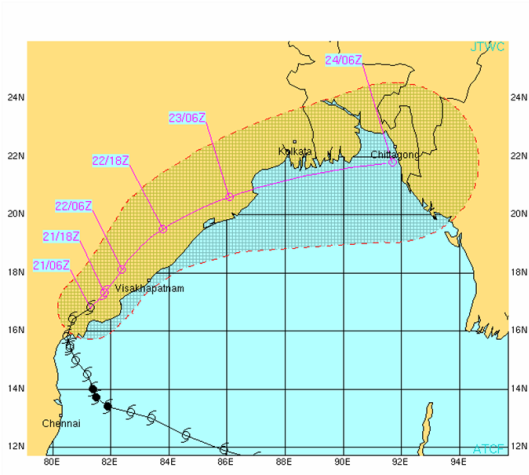
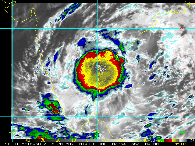
Laila made landfall on May 20 between 1100 and 1200UTC, about 50 kilometers from Bapatla, a small town in the Guntur District of the Andhra Pradesh State (Figure 1). Maximum sustained winds were 125 kilometers per hour, with higher gusts. Several hours before landfall, Laila was still relatively well organized (Figure 2), but an increase in wind shear over the Bay held the storm stationary and began disrupting its circulation just before it crossed the coast of India. As it moved inland, its windspeeds slowly weakened.

Figure 1: Observed and forecasted path of Cyclone Laila (Source: JTWC).

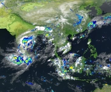
Figure 2: Satellite Image of Cyclone Laila (Source: NOAA). After landfall , the storm re-curved to the northeast, towards Orissa. The following day, May 21, Laila weakened to a depression and was centered over coastal Andhra Pradesh, about 100 km west of Kakinada. Heavy rains devastated large coastal stretches of the states of Tamil Nadu and Andhra Pradesh. Three districts of Andhra Pradesh--Nellore, Prakasam, and Guntur--were particularly hard hit. The towns of Addanki and Ongole received 55 centimeters and 32 centimeters of rain in a 24 hour period, respectively. Additionally, storm surge between 1.5 and 2 meters high inundated Andhra Pradesh’s coastal villages. The image below from the Japanese Aerospace Exploration Agency (JAXA) shows that precipitation intensities in excess of 50 mm per hour were occurring over land northwest of the storm's center at the time of landfall (Figure 3).


Figure 3: Hourly precipitation rate at landfall (Source: Japan Aerospace Exploration Agency). Strong winds from the storm uprooted trees and disrupted power and communication networks along the coast. The power supply was affected in about 1,490 villages and more than 11 towns. More than 19,000 acres of crops were damaged. Images below show the damage to public infrastructure. As a precautionary measure, Reliance Industries had shut down oil and gas production, which it resumed on Friday. Due to heavy rain and flooding leading up to the storm, Hinduja Foundries—which makes grey iron and aluminum gravity die-casting—shut down operations at its Ennore plant near Chennai . According to government authorities, disaster management teams have evacuated about 70,000 people in affected areas.

Figure 4: National Highway Number 5 inundated with water near Ongole (Source: Sakshi newspaper).

Figure 5: Damage of sea shore embankment at Uppada in East Godavari District (Source: Sakshi newspaper).

Figure 6: Damage to banana trees in Krishna District (Source: Sakshi newspaper).