Post Tropical Cyclone Sandy
Status: Closed
Post Landfall 1 | Summary
Posting Date: November 14, 2012, 10:00:00 AM
The photos and commentary in this report provide an initial glimpse into the kinds of damage patterns caused by Sandy in Manhattan, Coney Island, and Queens in New York and Ocean City, Atlantic City, Jersey City, and Long Beach Island, in New Jersey.
Sandy was a post-tropical cyclone when it made landfall around 8:00 p.m. EDT October 29, 2012, five miles southwest of Atlantic City, New Jersey. At landfall, the National Hurricane Center estimated a central pressure of 946 mb and sustained winds of 80 mph. Hours before landfall, Sandy’s central pressure reached a low of 940 mb—a reading that would usually be associated with more powerful hurricanes—but it remained a Category 1 storm. This was due to Sandy’s enormous size; tropical storm-force winds reached nearly 950 miles across, and hurricane-force winds extended 175 miles from the center. This allowed for a more gradual wind speed gradient between the eye and the outer bands, which mitigated the wind speed.
Sandy’s diameter made it the largest Atlantic hurricane on record in terms of the span of tropical storm-force winds. The huge radius helped to keep the winds at Category 1 intensity and allowed the storm to interact with a system from the west that resulted in severe weather across a wide swath of the eastern United States.
On November 11, 2012, two AIR teams were deployed to survey damage in New York and New Jersey. Team members included Dr. Karthik Ramanathan and Aditya Kistemasetty from AIR’s Research and Modeling group, Nihal Joag from Consulting and Client Services, and Jared Seaquist from Business Development.
The photos and commentary in this report provide an initial glimpse into the kinds of damage patterns caused by this event in Manhattan, Coney Island, and Queens in New York and Ocean City, Atlantic City, Jersey City, and Long Beach Island, in New Jersey.
This report will be followed by additional communications from a third team about damage patterns caused by Sandy in coastal communities of Rhode Island, Connecticut, and Long Island as well as further reports from our teams in New Jersey and New York. In general, damage caused by storm surge was much more severe than wind damage.
Atlantic City, New Jersey
The team has measured flood depths of six to eight feet in portions of Atlantic City, causing significant damage to commercial and residential structures located along the coast.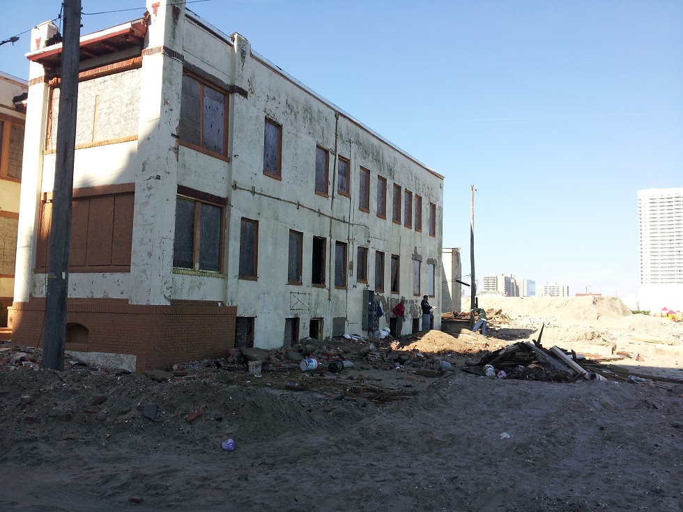
Figure 1: Significant surge damage to residential structures on the coast of Atlantic City (Source: AIR).
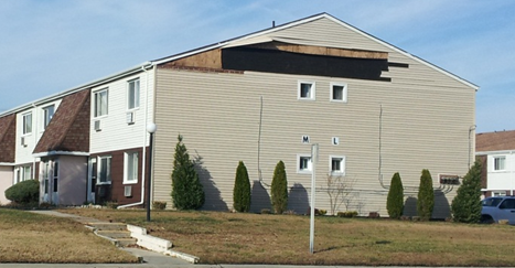
Figure 2: Wind damage to residential structure to the north of Atlantic City (Source: AIR).
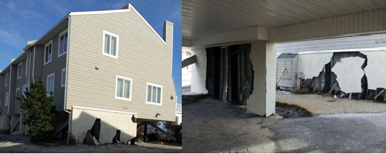
Figure 3: Significant surge damage seen on the northern side of Atlantic City (Source: AIR).
Ocean City, New Jersey
Ocean City experienced significant damage as a result of storm surge. In areas surveyed by the AIR team in Ocean City, flood depths of four to six feet were measured. Significant equipment damage, including to HVAC units, was observed, causing some stores to close for more than 10 days. Significant reconstruction is in progress to open the stores as soon as possible. Some buildings near the coast remain uninhabitable because of more than two feet of water still inside. In general, buildings with higher first-floor elevations experienced much lower levels of damage than buildings whose first floors were not elevated. Although there was significant damage to building components and contents from storm surge, wind damage was generally minor. A few buildings had some roof covering, wall siding, and flashing damage.Long Beach Island, New Jersey
Long Beach Island is a barrier island that runs along the coast of Ocean County, N.J. Homes here suffered significant surge damage to both their structure and contents. A few houses with low first floor elevation and weak foundation connections were completely displaced from their foundations.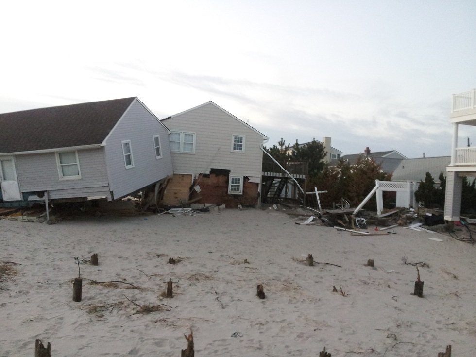
Figure 4: Displaced houses due to low first floor elevations and weak foundation connections (Source: AIR).
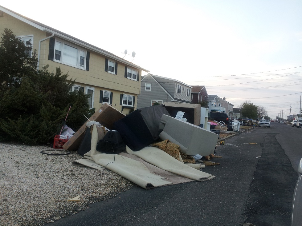
Figure 5: Content damage was widespread (Source: AIR).
Lower Manhattan
The AIR teams surveyed several different areas in Manhattan including the Battery, the Meatpacking District, Tomkins Square Park, and the neighborhood around FDR Drive. A record storm tide of 11.28 feet North American Vertical Datum (NAVD) was recorded at the Battery NOAA gauge in lower Manhattan and produced significant flooding, particularly in low-lying areas. At 111 Jane Street in lower Manhattan, an apartment building’s garage, about five feet below street level, was inundated with 7.5 feet of water, causing damage to cars. The garage is again open for business after being pumped and freshly painted, but many cars are still parked there waiting to be towed away. The basement of a hotel next door was flooded up to the ceiling with 15 feet of water, and six to seven feet of water at the ground floor level. All contents in the basement—including electrical equipment and elevator equipment—are a complete loss. It is not known at this time when elevator service will resume.West and Horatio Streets
On West and Horatio streets many buildings were inundated. The team surveyed the basement of a restaurant, whose compressors were completely destroyed, as was dry food. The basement roof collapsed, likely due to moisture ingress, and all contents of the freezer had to be discarded. The restaurant was out of business for two weeks, opening again only on November 10.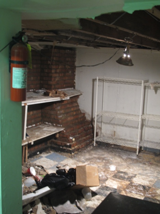
Figure 6: Basement of a restaurant on West and Horatio streets in Manhattan (Source: AIR).
Whitehall Street and South Street
The three below-ground stories of the parking garage of a commercial high-rise building at the intersection of Whitehall Street and South Street were completely inundated—with 40 to 50 feet of water. A hazardous material caution was issued due to the mixture of gasoline, oil, and other materials. Network server rooms, electrical and plumbing equipment, and elevators and escalators were damaged. The building tentatively expects to be back in business on the Monday after Thanksgiving, November 26. Stores across from South Street are still closed but are expected to be back in business this week, after electricity is restored in the area. Restaurants here are being cleaned of hazardous materials and general waste.Coney Island, Brooklyn
In Coney Island, most single-family and multi-family residences have basements—and most basements flooded. The ground floors were also flooded up to three blocks from the ocean. Debris lined the streets. The residential neighborhoods were protected by the police against looters, so the survey team could not assess the damage in detail in some of these neighborhoods.
Figure 7: Coney Island neighborhood with debris in the streets (Source: AIR).
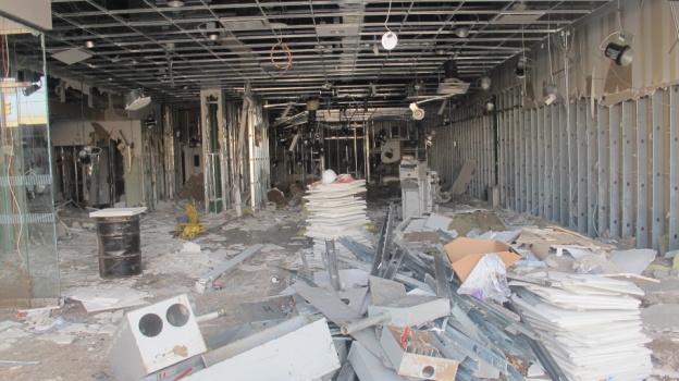
Figure 8: A bank branch on Coney Island (Source: AIR).
Rockaway, Queens
Of the areas surveyed by AIR thus far, Rockaway seemed to be the worst affected. However, given that the team was not allowed to survey the residential areas of Coney Island, this may not in fact be the case. Streets in Rockaway had debris everywhere, and the National Guard was helping with the cleanup. Wall foundations performed very poorly here. All houses surveyed that had wall foundations sustained severe damage. However, those houses performed better than those on wooden “mat” type foundations, where the main part of the house/appurtenant structures completely detached from the unit and collapsed. Uplifting was seen in the case of houses sitting on wooden columns. The AIR survey team did not observe any houses on stilts, which are the recommended foundation types in high-velocity flood zones (closest to the ocean), as defined by FEMA.
Figure 9: Poor foundation performance in Rockaway (Source: AIR).