Post Tropical Cyclone Sandy
Status: Closed
Post Landfall 3 | Summary
Posting Date: November 19, 2012, 7:00:00 AM
This report is the third in a series from AIR’s recently concluded damage survey of areas impacted by Sandy, which made landfall on October 29, 2012, five miles southwest of Atlantic City, New Jersey.
On November 11, 2012, two AIR teams were deployed to survey damage in New York and New Jersey. Team members included Dr. Karthik Ramanathan and Aditya Kistemasetty from AIR’s Research and Modeling group, Nihal Joag from Consulting and Client Services, and Jared Seaquist from Business Development.
The photos and commentary in this report provide an initial glimpse into the kinds of damage patterns caused by this event in Staten Island, New York, and Toms River, Point Pleasant Beach, Sea Bright, Keyport, Union Beach, Keansburg, Kearny, Secaucus, Moonachie, and Little Ferry, New Jersey.
In the areas surveyed, the majority of the damage in coastal areas was due to storm surge, and in inland areas it was due to riverine flooding. Wind damage was generally limited to roof coverings and wall siding. Significant damage was also caused by downed trees. The coastal neighborhoods from Long Beach to Keyport, New Jersey, experienced extensive to complete damage due to storm surge. Damage was seen to residential, commercial, and industrial structures and to their contents.
Staten Island, New York
Neighborhoods of Stapleton, Fort Wadsworth, Midland Beach, and New Dorp Beach
Stapleton is a neighborhood located in the northeastern part of Staten Island along the waterfront. The AIR team observed wind damage to property and uprooted trees along the coast. In residential and commercial sectors, evidence of extensive flooding at street level was observed—for nearly two blocks inland there were reports of flooding four feet above street level. Fort Wadsworth is a former U.S. military installation on the Narrows, which divides New York Bay into Upper and Lower halves. The AIR Team surveyed residential properties that were uphill and found moderate levels of wind damage, including loss of roof covering and damage to wall siding.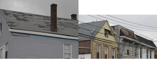
Figure 1: (Left) Loss of asphalt shingles in Fort Wadsworth; (right) damage to the siding of a house in Fort Wadsworth (Source: AIR).
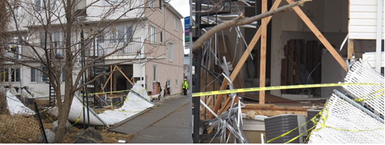
Figure 2: (Left) House in Fort Wadsworth with living room wall ravaged by storm surge; (right) close-up of damaged first floor showing complete damage to the structure and contents (Source: AIR).
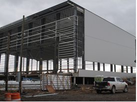
Figure 3: Athletic facility in Fort Wadsworth whose back facade metal sheeting was torn off completely (front and sides were unfinished before Sandy) (Source: AIR).
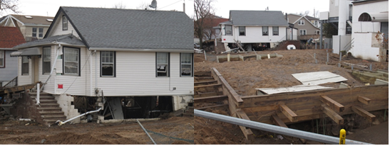
Figure 4: (Left) Wall foundation underneath building completely washed out in Midland Beach; (right) a house completely detached from its foundation in Midland Beach (Source: AIR).
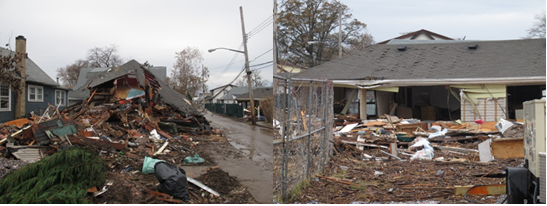
Figure 5: (Left and right) Catastrophic damage in New Dorp Beach (Source: AIR).
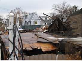
Figure 6: Catastrophic damage in New Dorp Beach (Source: AIR).
New Jersey
Toms River, Point Pleasant, Sea Bright
The AIR Team attempted to survey damage in Seaside Heights, but access to the area was restricted to residents only. The AIR Team surveyed the area around Seaside Heights, which sustained extensive surge damage. Most residential structures were rendered uninhabitable due to contamination caused by flooding. Almost all houses experienced contents damage; there was a great deal of debris in the road.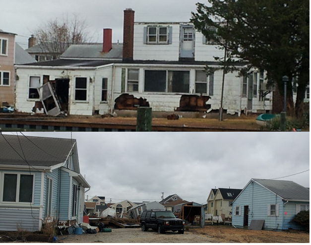
Figure 7: (Top) Significant damage to a house in Toms River (from wind and surge); (bottom) extent of loss in Toms River neighborhood (Source: AIR).
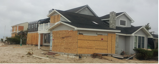
Figure 8: Surge damage to walls and windows of coastal buildings in Point Pleasant (Source: AIR).

Figure 9: (Left) Damage to a residential structure in Sea Bright; (right) complete collapse of a building in Sea Bright (Source: AIR).
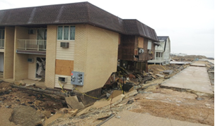
Figure 10: Foundation damage to coastal buildings in Sea Bright (Source: AIR).
Keyport, Union Beach, and Keansburg
Extensive storm surge damage and minor wind damage to roofs was observed in Keyport, Union Beach, and Keansburg areas of New Jersey.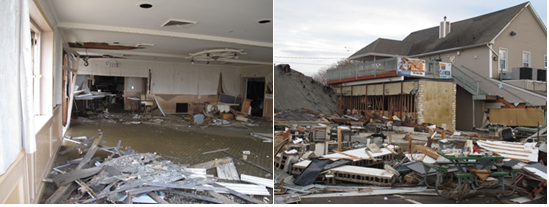
Figure 11: (Left and right) Extensive surge damage in Keyport (Source: AIR).
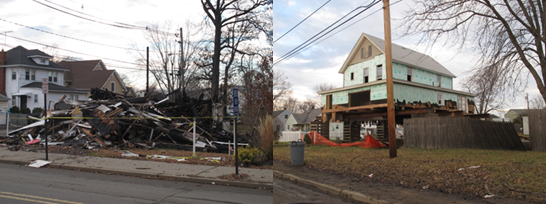
Figure 12: (Left) A completely damaged house due to storm surge in Union Beach; (right) missing foundation, floor, and heavy damage to the walls in a single-family house in Union Beach (Source: AIR).
Kearny
Kearny, an industrial area, experienced significant flooding, due to the overflowing of the Hackensack and Passaic rivers. The AIR team was able to tour one oil and natural gas storage facility. Based on conversations with the facility personnel, the facility saw close to two feet of flooding and was out of business for two weeks. This business interruption was at least partly responsible for the gas shortage in the area. A small portion of the facility’s operations resumed on November 9, and efforts to get the facility completely operational are ongoing. There was no storm protection in place at the facility, and the first set of storage tanks were less than 200 feet from the river banks. It is believed that some of the large storage tanks shifted from their platforms due to heavy river currents.Secaucus, Moonachie, and Little Ferry
In neighborhoods of Secaucus, Moonachie, and Little Ferry, watermarks indicated that riverine flooding reached a height of 22 inches several blocks away from the Hackensack River. Although no structural damage was observed, basement and garage contents had to be discarded. An industrial park and manufacturing facility in Little Ferry located on the banks of the Hackensack River experienced no flooding due to their flood protection systems of a concrete wall anchored in place by steel anchors and a concrete flood wall, respectively. The Teterboro Airport in Little Ferry experienced little wind damage, although a wind gust of 80 mph was recorded at the site. A few houses showed damage to asphalt roof shingles. This report concludes AIR’s damage survey of areas impacted by Sandy. The AIR Tropical Cyclone team is analyzing findings from the survey along with the latest available information regarding the parameters of the event itself. Analysis results will be used to update AIR’s modeled loss estimates for this storm, which will be available on the ALERT site on Monday, November 26.