Hurricane Danny
Status: Closed
| Type of posting | Posting date(EST): | Summary | Downloads |
|---|---|---|---|
| Pre-Landfall 1 | 8/21/2015 12:00:00 PM |
|
Pre-Landfall 1 | Summary
Posting Date: August 21, 2015, 12:00:00 PM
On Tuesday, August 18, Danny became the fourth named storm in the Atlantic in 2015, and the first hurricane of this El Niño year on Thursday, August 20. Danny was named more than a month after Claudette, a fairly unusual interval between named storms in the Atlantic at this time of year. With a radius of hurricane winds of only 15 miles, Danny is considered a very small hurricane. It has strengthened to a major hurricane, Category 3 on the Saffir-Simpson Scale, with maximum sustained winds of 115 mph. Danny is about 900 miles east of the Windward Islands. No additional intensification is expected.
Forecast Track and Intensity
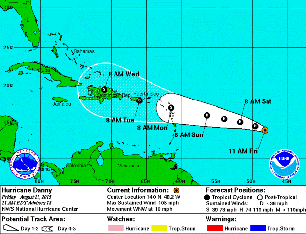
Hurricane Danny is expected to weaken after it enters an area of high shear and drier air, both of which will inhibit intensification. It is anticipated to weaken to tropical storm strength when it reaches the Northern Lesser Antilles on Monday morning, August 24.
Figure 1. Five-day forecast track for Hurricane Danny, as of 11 a.m. EDT on August 21. (Source: NOAA)
Exposure at Risk
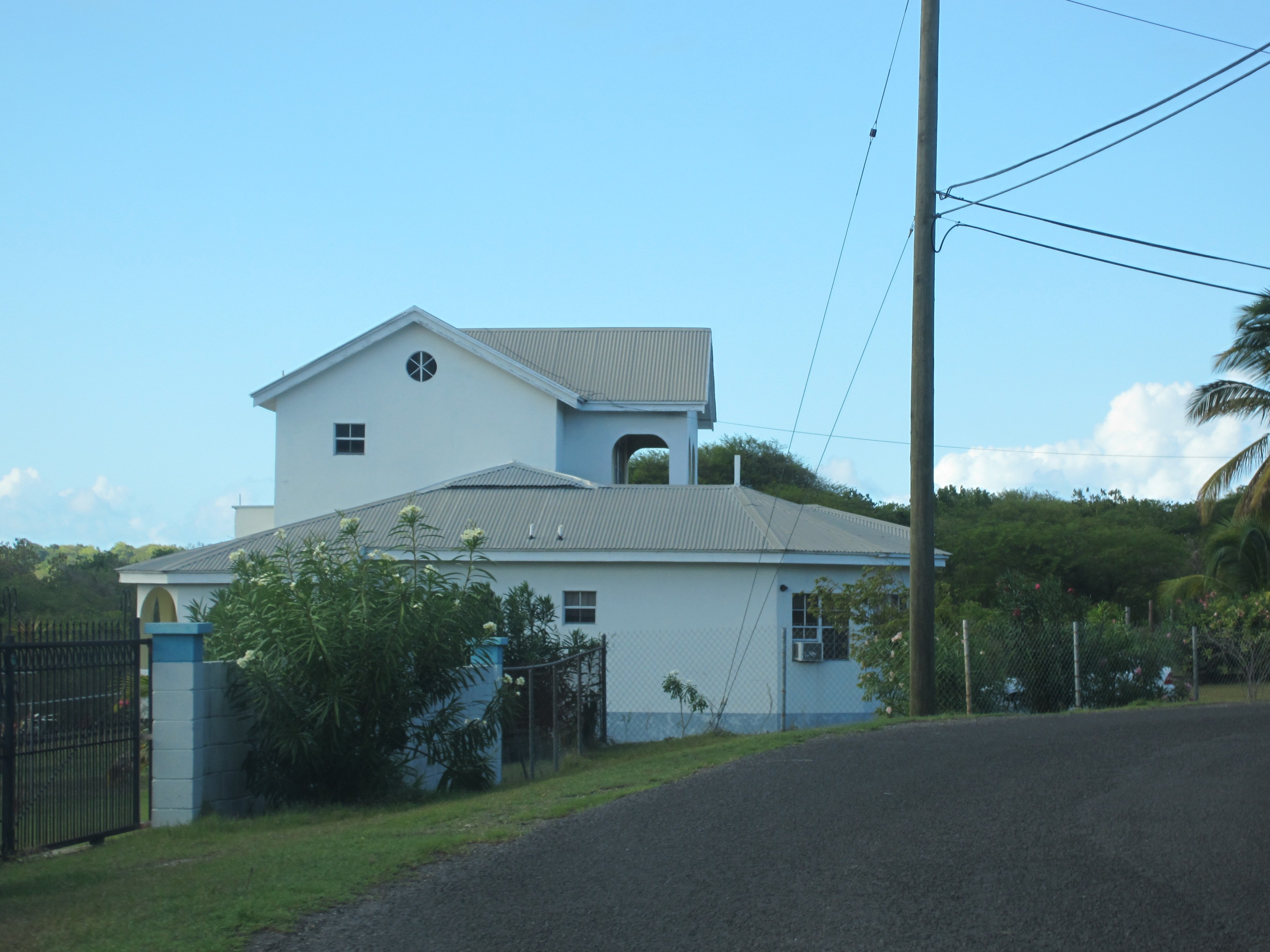
Given its size and forecast intensity, on its current track, Danny should have direct impacts on only a few islands of the Northern Lesser Antilles, mainly Antigua and Nevis. However, a slight shift in the track could cause the storm to impact other nearby islands instead. Antigua’s building inventory contains a large amount of unreinforced masonry, with wood frame and reinforced masonry making up the remainder of residential homes. Sheet metal roofs are very common in many of the territories in the Northern Lesser Antilles.
Antigua, Dominica, and Montserrat are all members of the Organization of Eastern Caribbean States (OECS), which has brought about building standards for these territories based on the Caribbean Uniform Building Code (CUBiC). Many member territories, including Dominica and Antigua, have taken steps to officially adopt these standards and given them the force of law. Although significant damage is not expected in any of the areas that are forecast to be impacted, some occasional damage may be seen to metal roof coverings or building envelopes. Only the most vulnerable (and likely uninsured) properties would see any significant damage.
Figure 2. Well-built concrete residence in Antigua (Source: AIR)
AIR Monitoring Tropical Storm Kilo
AIR is also closely monitoring Tropical Storm Kilo in the Central Pacific. As of 5 a.m. HST, Kilo was located 535 miles south-southeast of Hilo, Hawaii, and about 720 miles southeast of Honolulu, and is moving west-northwestward at 16 mph. Kilo has maximum sustained winds of 40 mph, with a minimum central pressure of 1004 mb. It is forecast to become a hurricane within the next three days.
Kilo is expected to move mainly northwestward through tomorrow evening. It will then make a turn northeastward. The exact timing of this turn is crucial to determine if Hawaii is at risk from this storm. If the turn occurs sooner, more of the islands will be at risk, including Oahu and Kauai. If the turn occurs later, the storm will bypass the main Hawaiian Islands on their western side.
During the past 24 hours, the track models have shifted a bit toward the west, which is good for residents of Hawaii, but the storm is still several days away. Storms that approach Hawaii from the south, such as Iniki (1992), are the most dangerous because they are over warm water for longer. Kilo will be approaching from the south, and it has the potential to become a Category 2 storm when it nears Hawaii on Wednesday, August 26.