Typhoon Soudelor 2015
Status: Closed
| Type of posting | Posting date(EST): | Summary | Downloads |
|---|---|---|---|
| Landfall | 8/10/2015 1:00:00 PM |
|
|
| Pre-Landfall 2 | 8/7/2015 1:15:00 PM |
|
|
| Pre-Landfall 1 | 8/5/2015 11:45:00 AM |
|
Pre-Landfall 1 | Summary
Posting Date: August 5, 2015, 11:45:00 AM
Typhoon Soudelor, the strongest tropical cyclone anywhere on earth thus far in 2015 based upon estimated wind speed, continues to track toward Taiwan. Earlier this week, the system crossed Saipan, population 48,000, in the Northern Mariana Islands. At that time the eye of Soudelor was extremely small—estimated at just 4 miles wide—but the storm made a direct hit on Saipan and strong winds caused significant damage across the island.
Meteorological Summary and Forecast
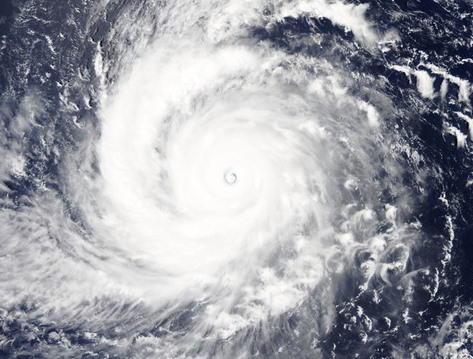
Since leaving Saipan, Typhoon Soudelor has increased in size and intensity and has tracked generally to the west around the southern periphery of the subtropical ridge. As of 15:45 UTC on August 5, the center was located at 20.05° N, 132.0° E, according to the Japan Meteorological Agency (JMA). Over the past 24 hours the system has weakened, its central pressure increasing from 900 hPa to 935 hPa, although Soudelor remains an intense and well-organized tropical cyclone (Figure 1). 
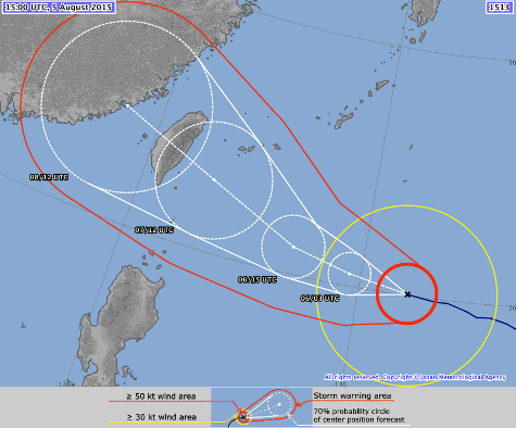
The JMA forecast anticipates little change in intensity over the next 12 hours followed by some strengthening prior to landfall on the east coast of central Taiwan late Friday or early Saturday local time (Figure 2). The JMA forecast indicates a central pressure of 925 hPa and 10-minute maximum sustained winds of 95 knots (~120 mph 1-minute sustained) prior to landfall. On this track, Soudelor would make landfall south of Taipei, although impacts would be felt across much of Taiwan. 
(Source: Japan Meteorological Agency)
Potential Impact
Although not directly in Soudelor’s anticipated track, the northeast of the country, where the capital Taipei is located, is likely to be most affected because of the concentration of exposure there. Any deviation of the storm from its forecast track to the north will result in more serious impacts for Taipei, while deviation to the south would tend to lessen impacts there.
The eastern two-thirds of Taiwan is the least populated area of the island, consisting mostly of rugged mountain ranges and dense forests lining a rocky coastline. The island’s high mountains can lead to extreme rainfall totals when strong typhoons make landfall, so flooding is a concern in addition to wind damage. The steep coastal bathymetry on the east coast will serve to reduce the threat from storm surge, although low-lying portions of the coastline could still see flooding.
After crossing Taiwan, Soudelor is forecast to make its final landfall in China, although interaction with the mountainous terrain of Taiwan will lead to considerable weakening prior to its arrival.
AIR’s tropical cyclone team will continue to monitor Typhoon Soudelor and provide additional information as events warrant.