Typhoon Hinnamnor
Status: Closed
| Type of posting | Posting date(EST): | Summary | Downloads |
|---|---|---|---|
| Similar Stochastic Events | 9/6/2022 4:00:00 PM |
|
|
| Monitoring Update #1 | 9/1/2022 4:00:00 PM |
|
Similar Stochastic Events | Summary
Posting Date: September 6, 2022, 4:00:00 PM
One of the strongest typhoons to impact the Korean peninsula in the past century, Typhoon Hinnamnor made landfall in South Gyeongsang province near the city of Geoje, with sustained 10 minute winds of 35 m/s (78 mph, 126km/h) and a minimum central pressure of 965 mb, per the Japan Meteorological Agency. The storm made a glancing blow to the southeastern portion of the country, first impacting Jeju island, before clipping the major port city of Busan and surrounding areas and accelerating northeast into the Sea of Japan.
Hinnamnor had the third lowest minimum central pressure of any storm to make landfall in South Korea in the historical record, trailing only Sarah (1959) and Maemi (2003). However, despite comparable minimum central pressure and track to Maemi, damage was significantly less from this storm, in part because of lower wind speeds from Hinnamnor, and in part because the storm spent far less time over land than Maemi (about two hours vs. Maemi’s six). The storm’s impacts also appear at this writing to have not been severe as those from Typhoon Rusa (2002).
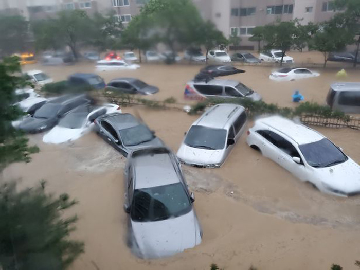
Despite the storm’s relatively short interaction with South Korea, given the landfall angle and forward speed, significant rainfall is one major story from this event. According the Korea Herald, between Saturday and Tuesday morning, the mountain area in Jeju had an accumulated rainfall of 1,058 millimeters. Gyeongju, South Gyeongsang Province had 447.5 mm of rain, and Ulsan also had 385.5 mm of rain. Pohang in particular appears to have been especially hard hit by flooding impacts, with rain induced landslides reported, as well as significant infrastructure damage and multiple bridge collapses. Rainfall rates of 4” per hour and isolated locations reporting 20” of rain in addition to strong tropical storm winds battered this region.

ALERT™ subscribers can download similar stochastic event (SSE) IDs for this event from the Downloads tab. Compatible with Touchstone® and Touchstone Re™, the SSEs were selected based on event parameters (not industry losses) and should be used only for exposures in South Korea.
Verisk has selected three stochastic events as proxies for modeling this event. They were selected based on the estimated minimum central pressure, track and landfall location, landfall angle, and forward speed of Hinnamnor. Historical typhoons Rusa and Maemi were used as benchmarks.
This is the final currently scheduled ALERT for Typhoon Hinnamnor. Please contact your Verisk representative with any further inquiries on this event.
Similar Stochastic Events | Downloads
Posting Date: September 6, 2022, 4:00:00 PM
The information provided herein is strictly confidential and is solely for the use of AIR clients; disclosure to others is prohibited.
Similar Stochastic Event IDs
Note: These lists give event IDs taken from our stochastic catalog that have similar characteristics as the current event.