Hurricane Elsa
Status: Closed
| Type of posting | Posting date(EST): | Summary | Downloads |
|---|---|---|---|
| Final Update | 7/7/2021 3:00:00 PM |
|
|
| Event Update 4 | 7/6/2021 9:00:00 AM |
|
|
| Event Update 3 | 7/5/2021 9:00:00 AM |
|
|
| Event Update 2 | 7/4/2021 9:00:00 AM |
|
|
| Event Update 1 | 7/3/2021 9:00:00 AM |
|
|
| Event Summary | 7/2/2021 1:00:00 PM |
|
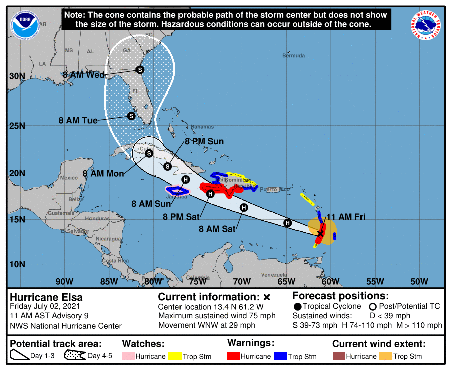
Event Summary | Summary
Posting Date: July 2, 2021, 1:00:00 PM
|
As of the 11 a.m. National Hurricane Center (NHC) advisory, Hurricane Elsa is located at 13.4°N, 61.2°W, with a minimum central pressure of 995 mb and maximum sustained 1-minute wind speeds of 75 mph. The storm is moving west-northwest at 29 mph, and is expected to remain on this trajectory for the next couple of days, before turning farther to the north. Hurricane warnings are in effect for St. Lucia, St. Vincent and the Grenadines, and the southern portion of Haiti from Port Au Prince to the southern border with the Dominican Republic. Tropical storm warnings have been issued for Barbados, Martinique, Dominica, the southern coast of Dominican Republic from Cabo Engaño to the border with Haiti, the coast of Haiti north of Port Au Prince, and Jamaica. |